Friday, August 30, 2013

The Killdeer Mountain Battlefield Landscape


The Killdeer Mountain Battlefield Landscape

Basin Killdeer Proposed Route
The Bismarck Tribune’s graphic of the proposed route through what essentially is the Gettysburg of the Northern Great Plains, the Killdeer Mountain Battlefield from 1864. Historical actors involved included Sitting Bull, Inkpaduta, Gall, Sully, among others.
This morning a story broke in The Bismarck Tribune on a proposed transmission line route directly through the core area of the Killdeer Mountain Battlefield. North Dakota State University’s Center for Heritage Renewal, led by Professor Tom Isern, responded with the following media release:
Aug. 30, 2013
Media Advisory
The Center for Heritage Renewal at North Dakota State University is preparing a submission for the North Dakota Public Service Commission hearing in Killdeer on Sept. 4. The subject is an electrical power transmission line and substation proposed to be built, by Basin Electric, in the core area of the Killdeer Mountain Battlefield. The topic has been covered by North Dakota media, starting yesterday.
The Center for Heritage Renewal was established to identify, preserve and capitalize on the heritage resources of North Dakota and the northern plains. One of the center’s objectives is to assist state agencies, private organizations and the people of the state and region in generating prosperity and quality of life from heritage resources. Another objective is to provide expertise and action in the fields of historic preservation and heritage tourism.
The center recognizes the efforts of Basin Electric to support regional development but is concerned that the environmental impact statement for the project takes no cognizance of the historical significance of Killdeer Mountain. 
The center has signed a contract with the National Park Service to survey and study the Killdeer Mountain Battlefield, which the park service has identified as a significant Civil War-era site in North Dakota. The contract is with the American Battlefield Protection Program of the National Park Service.
Killdeer Mountain was the chosen ground on which Dakota and Lakota fighters, including Inkpaduta and Sitting Bull, confronted the Northwest Expedition, commanded by General Alfred Sully, on July 28, 1864. This was the largest military engagement ever to take place on the Great Plains of North America, and a crucial episode in the Dakota War of 1862-1864.
University Distinguished Professor Tom Isern, founding director of the center, observes, “Killdeer Mountain is the Gettysburg of the Plains. It is, arguably, the most significant historic site in all of North Dakota.”
Isern is available to discuss this issue. He can be reached at 701-799-2942 
More to come…

http://theedgeofthevillage.com/2013/08/30/killdeer-mountain-battlefield-landscape/

Power line proposed in Killdeer Mountains area

Published August 30, 2013, 08:16 AM

Power line proposed in Killdeer Mountains area

A power company is planning to build electrical transmission lines and a substation in the area of a historical 1864 battle between Army soldiers and American Indians in what is now western North Dakota.
By: Associated Press,
BISMARCK, N.D. (AP) — A power company is planning to build electrical transmission lines and a substation in the area of a historical 1864 battle between Army soldiers and American Indians in what is now western North Dakota.

An alliance seeking to protect the environment and history of the Killdeer Mountains already is battling oil drilling there, and member Rob Sand calls the new proposal "alarming."

Basin Electric Power Cooperative plans to build a line from its Antelope Valley Stations near Beulah west and north into the Bakken oil fields to meet a huge demand for electricity, The Bismarck Tribune reported.

The transmission line route and a new substation would be located where the Army, led by Brig. Gen. Alfred Sully, fought with several bands of Sioux more than 200 years ago. The battlefield is now a state historic site.

The area recently was selected by the National Park Service for its American Battlefield Protection Program. A two-year study will be led by North Dakota State University history professor Tom Isern, who signed the contract just days ago.

Isern said the study will look at battlefield history and archaeology and identify threats to its integrity. Some of the integrity involves aesthetics, he said.

"If they were going to situate a power line to provide maximum disruption to the sightline of this battlefield, this plan will do it," he said.

Project coordinator Curt Pearson said Basin hired an archaeologist to inventory the area.

"No significant cultural sites were identified that would be impacted by this transmission line project," he said. "Because this NPS study is a new development that came about after the required inventories and reports were completed and submitted to the review agencies, we have not had time to fully analyze the significance of this situation."

Sand, who lives near the historic battlefield, coordinates the Killdeer Mountain Alliance, which formed when Hess Corp. filed for oil drilling permits near the battlefield early this year. Hess has said it is committed to safeguarding the environment.

"It's one thing after another," Sand said of the power line proposal. "It is alarming."

The Public Service Commission, which regulates the energy industry in North Dakota, will hold a hearing on Basin's proposal Wednesday at the Killdeer City Hall. Basin is asking the PSC to approve the 200-mile route for spring construction. Basin also has filed notice that it wants to build a second power line in the area.
http://www.grandforksherald.com/event/article/id/271990/

Thursday, August 29, 2013

Map of Killdeer Mountain Battlefield and Basin Electric Transmission Line and Substation


This map represents a proposed transmission line and substation (in blue) that Basin Electric Power Cooperative plans to build through the Killdeer Mountain Battlefield site that will be studied in a National Park Service American Battlefield Protection Program. The map also shows an extension (in pink) that Basin says it may also build to add stability to the Bakken oil patch power supply.
http://bismarcktribune.com/killdeer-mountain-battlefield/image_8f2350ee-10f5-11e3-a025-0019bb2963f4.html

Basin wants power line inside Killdeer Mountains battlefield study area

Basin wants power line inside Killdeer Mountains battlefield study area


BISMARCK, N.D. — The fight to preserve the Killdeer Mountain historic battlefield from oil development will move to another front, this time where a power company plans to build transmission lines and a substation in the heart of where the battle was fought.
Basin Electric Power Cooperative plans to build a new major line from its Antelope Valley Stations near Beulah west and north into the Bakken to help fill a huge appetite for electricity in the oil patch.
The transmission line route and a new substation would be located where the U.S. Army, led by Brig. Gen. Alfred Sully, and several bands of Sioux engaged in 1864.
It is an area just selected by the National Park Service for its American Battlefield Protection Program. The two-year study will be led by Tom Isern, history professor at North Dakota State University, who signed the contract days ago.
The Public Service Commission will hold a hearing at 10:30 a.m. Wednesday at the Killdeer City Hall to decide whether to put the transmission project on a fast track. Basin is asking the PSC to waive certain procedures and timelines and approve the 200-mile route for spring construction.
Basin's project coordinator, Curt Pearson, said Basin has only known about the NPS study since Tuesday.
Pearson said Basin hired a contract archaeologist to inventory the area as part of its application and environmental process.
"No significant cultural sites were identified that would be impacted by this transmission line project," Pearson said. "Because this NPS study is a new development that came about after the required inventories and reports were completed and submitted to the review agencies, we have not had time to fully analyze the significance of this situation."
He said Basin hopes to come to a reasonable conclusion "as we work through this issue."
Isern said the study will look at battlefield history and archaeology and identify threats to its integrity. Some of the integrity involves aesthetics, he said.
"If they were going to situate a power line to provide maximum disruption to the sightline of this battlefield, this plan will do it," he said.
Rob Sand, who lives near the historic battlefield, is a member of the Killdeer Mountain Alliance. The alliance was formed to give a voice to the mountains and battlefield when Hess Corp. filed for permits to set an eight-well drilling pad near the battlefield early this year.
"It's one thing after another. It is alarming. We've loved it and taken it for granted," Sand said.
He said Isern's study coupled with a recent tour of significant sites in the oil patch by Gov. Jack Dalrymple, as a member of the state Industrial Commission that approves drilling permits, should give pause to Basin's plans.
"The Industrial Commission is at least pretending to be interested in protecting special places and with Isern's study, those two things say they should hold off and don't be putting something like that out there," Sand said. "If they're starting to consider special places, the state needs to support that."
Even as Basin goes through the formal process to build the new 345-kV line from its coal plant to the oil patch, it has filed notice that it wants to build a second line, using the alternate route studied for the one going through the PSC hearings next week.
The second line would kick off the new substation and be routed north through the battlefield zone toward the oil patch.
Basin spokesman Daryl Hill said the second line would provide more power to the oil patch region and build in some redundancy in case of a major outage.
"As power load studies have progressed, there's good cause for using that alternate as well," Hill said.
Isern said the study will document "what went down and where" during the battle, which he said is the largest Army and Plains Indian engagement to ever take place in the Great Plains.
"It was way bigger than (Custer's) Battle of the Little Bighorn. Sully came out with his mid-century modern warfare, formed a square and he had all he could handle. Eventually, he turned his howitzers on the women and children on the slopes," Isern said.
Sully brought 2,200 men to fight 1,600 Sioux. Twelve years later, Custer took 650 men to fight an estimated 900 to 2,500 Plains Indians.
The NDSU study will look at the historical significance of five known battlefields in North Dakota, including Killdeer Mountain, for possible inclusion in the National Register of Historic Places.
Hill said Basin has filed notice for a supplemental environmental impact statement for the second line.
The environmental clearance is required for both projects because the cooperative will use federal financing under the USDA Rural Utilities Service.

Friday, August 23, 2013

New power substation is an insult

Letter: New power substation is an insult

Posted on 23 August 2013 by admin
Editor: As a fourth generation Killdeer Mountain land owner, I want to call attention to the Public Service Commission’s 9:30 a.m. hearing on Sept. 4 at the City Hall regarding the Basin Electric Power Cooperative proposal to construct of a new transmission line and substation near Gumbo Creek north of Killdeer.  
Posted August 23, 2013
A poorly rendered map can be seen in the Aug. 16 Herald.
A review of the detailed maps available at the Public Service Commission website clearly shows that the newly proposed substation would be constructed on Section 31 of Township 146, Range 95 which is within the boundary of the Killdeer Mountain Battlefield as identified by the National Park Service in its 2010 survey of the historic area.
The Cooperative thus is adding insult to injury in not only constructing its lines within the battlefield’s boundaries, but adding this 12 acre substation!
My great-grandmother, Susan Veigel, and grandfather, Walter R. Veigel, the original surveyor of this area, acquired their properties along the Gap Road because of their beauty and abundant resources.
I understand that the continuing degradation by oil development is driven by the need for resource access.  The location of power transmission facilities is not.
I urge all those interested in preserving the integrity, beauty, and history of the Killdeer Mountains and its viewscape to attend the meeting and voice their objections to this plan and the Commission’s request to accelerate the approval process.

Thursday, August 22, 2013

After the 'gold rush'

After the 'gold rush'


LITTLE MISSOURI STATE PARK, N.D. — Gov. Jack Dalrymple spent more than nine hours Thursday touring nine western North Dakota sites of historical, cultural or ecological significance that are nestled smack-dab in the middle of oil country.
The tour, a first for a member of the state Industrial Commission since the legislative session, included a flyover of other areas from Belfield to Medora to Watford City. The Industrial Commission — chaired by the governor with members Attorney General Wayne Stenehjem and Agriculture Commissioner Doug Goehring — had said it would conduct the tour as a group, but Dalrymple said individual schedules have not allowed that.
Terry Steinwand, director of the North Dakota Game and Fish Department, and Mark Zimmerman, director of the North Dakota Parks and Recreation Department, accompanied Dalrymple on the tour.
Cities and counties in the West, as well as tourist destinations, have felt the crunch of energy development as it has encroached near their boundaries.
Since the 1970s, Badlands Trail Rides has co-existed with the state park, catering to riders who bring in their own stock or guiding them along the 50-some miles of trails that wind through the Badlands.
Twila and Tom Benz are one of three families in the area who lease land to the state park for trails. They also have five rental cabins but in the past couple of years, visitation has dipped. Jesse Hanson of the state Parks and Recreation Department said that has also been the case at the state park.
State Highway 22, which runs north of Killdeer 19 miles to the park's entrance, has been under construction for the past two years, and Hanson said between the construction, gas prices, the economy and truck traffic, visitation has been down.
He said last year the park had about 1,400 campers total. "We had been going up steadily," Hanson said.
It's a crunch other areas in the West have been feeling as well.
Dalrymple's tour included visits to the Theodore Roosevelt National Park north and south units, the Long X Divide, Lone Butte, Killdeer Mountains Wildlife Management Area, Killdeer Mountain Battlefield, Elkhorn Ranch and Twin Buttes.
Rob Sand, who lives in the Killdeer Mountains near the historic battlefield, is a member of a loosely formed group known as the Killdeer Mountain Alliance. The group has been urging the governor and the state to proceed cautiously during the permitting process with drilling and other oil activity near sensitive areas, as in the case of the battlefield.
Sand said he is not opposed to private landowners developing their land and minerals for energy production, but he would like to see some sort of strategy to establish infrastructure like roads, water and electricity ahead of time.
"Whatever they can do to mitigate things," Sand said.
Dalrymple said once Stenehjem and Goehring are able to tour the region first-hand, that type of planning can begin.
"We're not blind to the situation and the effect it has on the environment," the governor told reporters at the state park.
He said while landowners have the right to develop their property, the state can add special provisions to permits in sensitive areas. Dalrymple said those provisions, some of which have already been added by oil companies, could include altering locations of pads or roads.
"We have the power of the permit over them," he said. "That has been the new regime since I became governor ... and I think it has been working well."
Aside from the ecological and cultural issues, some worry about quality of life issues. With big oil and big money moving in at a frantic pace, western North Dakota has lost much of its charm and natural beauty, they say.
Florenda Holen is the volunteer host at the state park. From Wallhalla, she said, her family has moved to the western part of the state to earn a living. She has seen her son and his family move from Williston to Alexander because of an increase in crime and the high cost of living.
Holen said they are now considering a move to Bismarck to further distance themselves from the boom. She said she worries about the future of not just western North Dakota, but of North Dakota's way of life, which appears to vanishing.
"You look at the rim (Badlands horizon) at night and it's lit up by flaring," Holen said. She said when the boom is over one day, she hopes there will be something left for people to come back to. In the meantime, she said, it's tough to make a living and a life right now for many younger people who want to call western North Dakota home.
"We need something now so these people can keep a job ... they want a life, not a gold rush," Holen said.

Wednesday, August 21, 2013

North Dakota makes list of sites threatened by oil drilling

North Dakota makes list of sites threatened by oil drilling


BISMARCK, N.D. _ Roadless tracts of grasslands, numerous parks, wildlife areas and North Dakota's highest peak at White Butte are among 40 sites in the western part of the state that have been nominated for increased protection from oil drilling.
The list was compiled by the state Industrial Commission with comments from the public, environmental groups and government agencies over the past two years, said Karlene Fine, the commission's director.
Gov. Jack Dalrymple is chairman of the commission, which regulates North Dakota's oil and gas industry. Attorney General Wayne Stenehjem and Agriculture Commissioner Doug Goehring are its other members.
The men — all Republicans — are slated to visit most of the sites in western North Dakota's oil patch over the next several weeks.
Jeff Zent, a spokesman for Dalrymple, said scheduling conflicts prohibit the panel from traveling together.
Dalrymple was slated to begin his tour Thursday to see areas identified as having historical, cultural and recreational significance, as well as areas that support unique wildlife and plant habitat, Zent said.
"The governor will be going out west. He already has seen a lot of western North Dakota but he does want to go back out there to look at some specific sites," Zent said. "It may work out best in the long run to have the commissioners go out individually because they may be able to cover more ground."
Many of the sites identified on the list are on state or federal land and several of those are intermingled with private land, Fine said.
Wayde Schafer, a North Dakota spokesman for the Sierra Club, said the mixed bag of land ownership creates a "patchwork of problems" for conservation groups and regulators.
"It's not clear what level of protection the Industrial Commission has for these sites," Schafer said. "Each of these sites will have to have their own set of solutions to protect their historic or ecological significance."
Further complicating oversight of culturally or environmentally sensitive areas is that a tract of land in North Dakota can have separate owners, above and below ground. Surface owners are typically trumped by mineral owners who are allowed to access the land for exploration under state law.
"Mineral owners in this state can develop their minerals," said Goehring, of the Industrial Commission. "We just have to address concerns and minimize those impacts."
Goehring said some examples include requiring companies to build roads or place wells in the least intrusive areas possible, or even requiring companies to paint tanks and other equipment so that it blends with the landscape.
Stenehjem said he often vacations in western North Dakota and has done so as late as last weekend. He already has visited many of the identified sites and intends to look at more of them in the coming weeks.
Of particular concern, he said, is the issue of natural gas flaring in western North Dakota, where about 30 percent of the state's gas production is being burned off or "flared" because development of the pipelines and processing facilities needed to handle it has not kept pace with production.
"We've done a lot but we need to do more," Stenehjem said.

Saturday, August 17, 2013

Environmentalists react to protected site list

Environmentalists react to protected site list

The state has compiled a list of sites it might review for protections from drilling, and while environmentalists say it’s a good start, they caution that it’s not nearly enough.
By: Katherine Lymn, The Dickinson Press
Published August 17, 2013, 12:00 AM
The state has compiled a list of sites it might review for protections from drilling, and while environmentalists say it’s a good start, they caution that it’s not nearly enough.
The list of about 40 wildlife management areas, buttes and other significant sites is a tentative selection of where North Dakota’s governor, attorney general and agriculture commissioner, who make up the state’s Industrial Commission, may tour and then consider preserving.
But the list represents how little is left of North Dakota wilderness for Wayde Schafer, organizer of the state’s Sierra Club.
“It’s gotten to the point where they’re all special because it’s all that’s left,” he said.
Representatives from the offices of each commission member didn’t know of much touring the members had done and didn’t know their plans for the future. The Industrial Commission wants to finish the visits by winter.
Many of the list sites were on a preservation proposal from Schafer’s club back in the ’90s. Half of those proposal sites have since seen energy development.
Now the window of opportunity to protect enough Badlands to have a quality wildlife experience is closing, he says, and people are realizing what they’re losing.
“Everybody becomes an environmentalist when their backyard is threatened,” Schafer said, “and that’s what’s happening.”
Badlands Conservation Alliance President and state Sen. Connie Triplett said she thinks the initiative is just a result of public pressure, but she’s glad the state responded.
Still, she said, broader regulations are necessary for all drilling applications on state school lands.
“The notion of just picking a few selected sites is a really short-sighted way to think about this,” said Triplett, a Democrat from Grand Forks.
Alison Ritter, spokeswoman for the Industrial Commission’s Oil and Gas Division, said the commission has maps to compare proposed drill sites with any restricted areas, and it also posts approved permits online for three days of public comment before operators can build.
Triplett and others say they’re also interested in how the list is used, not just what’s on it.
If the Industrial Commission doesn’t actually use the list to inform its decision-making, she said, “it will have been a waste of time.”
Karlene Fine, executive director of the Industrial Commission, said the list is nearly complete but that the commission members are “always open for suggestions.”
Multiple environmentalists said the list is missing significant sites, like wildlife management areas and wildlife refuges in the Oil Patch.
Triplett said she has asked Fine for the original list of citizen suggestions, and for a description of how the Industrial Commission narrowed it down if it did.
The environmentalists say they don’t want to stop drilling — they just want the state to be more mindful about where it’s allowed.
“It’s about making sure that enough voices are heard so that the drilling takes place in a way that doesn’t damage other values that many people care about,” Triplett said.
She said “no-surface occupancy,” noise-reducing equipment and shifting site locations are some ways for developers and land advocates to compromise.
Commission member Gov. Jack Dalrymple has said horizontal drilling can help to avoid sensitive drilling areas.
The governor’s trips are going to be informal visits, spokesman Jeff Zent said.
“(Dalrymple) wants to go out there just to see these sites for himself and to cover all bases,” Zent said.
Environmentalists, like blogger and longtime North Dakota outdoors activist Jim Fuglie, say the state is so far behind with protecting its lands that the list is just not enough.
“The oil’s not going anywhere but there’s just so much money to be made that everybody wants to get it now and that’s the problem,” he said.
“It wouldn’t hurt to slow things down a little bit.”
Triplett, meanwhile, says the list is “better late than never.”

http://www.thedickinsonpress.com/event/article/id/71221/

Friday, August 16, 2013

The Industrial Commission Has A List. What Next? How About A Breather?

The Industrial Commission Has A List. What Next? How About A Breather?

Well, okay, now there’s a list. On paper. Well, at least on a computer screen. It’s a list that the North Dakota Industrial Commission is “considering for at least one Commission member to tour” as they look at protecting places that have particularly sensitive archeological, paleontological, historical, recreational or environmental characteristics. That’s a start.
I wrote about this before. Back in May, the Industrial Commission, at the urging of Attorney General Wayne Stenehjem, decided to make a list of special places and go on a tour to see what makes them special. And then this group of three important state officials, who issue all the oil and gas drilling permits in the state, would decide if any of those areas should be protected from oil development. The list, which you will find below, “is tentative and is being revised as scheduling is worked on.”
Okay, so what next? Actually, the better question is, what has happened recently? Since the Commission decided to do this, with much ballyhoo and great media coverage, probably 500 or more drilling permits have been issued to oil companies with no regard to the places on this list, at least as far as I can tell. Who knows how many of them are in, or on, or next to, the places on this list? Nobody, to my knowledge.
Then, at their last regular meeting, the Commission decided not to take a group tour, but to try to get to see as many of them individually as possible when their travels took them to western North Dakota. When will that be? Of course, nobody knows. Meanwhile, the Commission keeps on issuing drilling permits—at last count, as of Friday afternoon, 137 of them so far this month. And the month is just half over.
Is the list a complete list of places that ought to be considered “off limits” to oil activity? Not by a long shot. It’s a pretty good compilation of state and national parks, important historic sites, roadless areas treasured by hikers and hunters, and some wildlife habitat areas. But there’s a lot missing from this list. For example, there are about 30 North Dakota Wildlife Management Areas—places set aside to help provide wildlife habitat to our game and non-game species—in the area known generally as the “Oil Patch.” Only six of them are on the list. There are about ten National Wildlife Refuges in the same area. Only three are on the list. Hunters, birders and hikers ought to be pretty concerned about that.
We’ve got serious wildlife problems already out west, especially among mule deer, antelope and sage grouse populations. Those species are not making babies like they used to. They’re finding it pretty hard to get romantic with oil trucks running through their bedrooms.
I’m not even sure where this list came from. I asked officials at affected state agencies today if they had seen it, and none had. So those state agencies—Parks, History and Wildlife—haven’t even had any input yet. That seems strange. You’d think the Industrial Commission would want their paid experts to weigh in on this. I’d sure like to hear what they have to say.
So back to my question: What’s next? Here’s my suggestion.
Using this list as a starting point, bring in the state agency experts, add the wildlife areas and any missing significant cultural and recreational sites, and then hire someone to sit down with a map and a computer and make a database of the legal descriptions of all these places. That shouldn’t take more than a few weeks. The list isn’t that long.
Then every time a request for a drilling permit comes in, run the legal description against the database. If you get a match, set the application aside and have a good discussion, at an open meeting, with all interested parties present, about whether that permit ought to be issued or not. If it’s in a sensitive wildlife area, bring in Terry Steinwand’s folks and see what they think. If it’s an Indian burial ground, bring in Merl Paaverud. You get the idea.
Meanwhile, until the list is updated and the database is completed, I suggest we issue a moratorium on any further drilling permits. I guarantee they would get that database done in a hurry if they did that.
I’m dead serious about this. Like I said, it shouldn’t take more than a few weeks to decide on a list and make the database. Until then, just stop issuing drilling permits. That won’t shut down the oil industry. It won’t even slow it down. There are plenty of undrilled permits out there right now. The drillers will be plenty busy. They’ve probably got work stacked up for a year into the future, or longer, right now.
But it’s a good idea in any kind of game to stop and take a breather once in a while. This is the kind of breather we could all use right now—putting some thought into where oil wells should be located, instead of this mad frenzy we’ve been going through the last few years. It would show that the state is serious about protecting special places. After all, Jack Dalrymnple, Wayne Stenehjem and Doug Goehring said they were serious about it back in May. But nothing has happened since then. It’s time to make this happen. Otherwise, many more months, maybe years, are going to go by, and many hundreds, maybe thousands, of drilling permits are going to be issued, with no regard to this list of special places. That just seems goofy to me.
Here’s the list. What would you add?
Antelope Creek Wildlife Management Area
Black Butte
Bowman Haley Dam and Recreation Area
Bullion Butte
Chalky Buttes
Custer Campsites
Davis Dam
Deep Creek Bottoms
Ft. Dilts
Fort Union National Historic Site
Hofflund Wildlife Management Area
Initial Rock south of Fryberg
Kendley Plateau or is it spelled Kinley Plateau
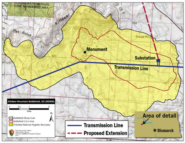
Killdeer Battlefield
Killdeer Wildlife Management Area (Primitive Area)
Lake Ilo National Wildlife Refuge
Lewis and Clark State Park
Little Missouri River State Park
Lone Butte
Long X Divide
Lostwood National Wildlife Refuge
Medicine Hole on the Killdeer Mountain
Och’s Point Wildlife Management Area
Ponderosa Pine
Pretty Butte
Schnell Recreation Area
Sheyenne Grasslands
Square Butte
Stewart Lake National Wildlife Refuge
Strom Hanson IRA
Sulllivan Wildlife Management Area
Sully Creek State Park
Theodore Roosevelt National Park—North, South and Elkhorn Units (Elkhorn Ranchlands)
Tracy Mountain
Trenton Wildlife Management Area
Twin Buttes
White Butte
Writing Rock south of Alkabo
All Little Missouri River National Grassland Roadless Areas
- See more at: http://theprairieblog.areavoices.com/2013/08/16/the-industrial-commission-has-a-list-what-next/#sthash.3N8HIGVH.dpuf

The Great Victory at Battle of Apple Creek, 150 Years Later

Dakota Wind
A view from the top of Pictured Bluff looking northwesterly towards Sibley Park, which is where Camp Slaughter once stood.

The Great Victory at Battle of Apple Creek, 150 Years Later

August 16, 2013
TheMníšoše, Missouri River, moves determinedly along the ancient valley it has carved over thousands of years. The river flows in the very heart of the Great Plains, in fact, aside from the wind it’s a defining feature of the prairie steppe. ItsLakȟótaname means “The Water A-stir” in reference to its muddy stirred up appearance in historic times. Commercial traffic on the river in the nineteenth century came to call it “The Big Muddy.”
Tȟaspáŋla Wakpála, Apple Creek, meanders along its own course from a field north and east of present-day Bismarck, North Dakota. The Menoken Indian Village rests along the quiet creek, a silent witness to trade in what archaeologists call the Late Woodlands period. The creek’s name refers to the tree that bears the tiny edible thorn apple.
Where theTȟaspáŋla Wakpálaconverges withMníšošeisMayá Itówapi, Pictured Bluff. There, along the bluff are caves where the sediment is layered in colors. A testament to the changing climate throughout the ages of the world to the geologist, but to theLakȟóta, it was a place to gather natural yellow and red pigments to create paint.
There was a conflict between thePȟadáni(Arikara) and theIháŋktȟuŋwaŋna(Yanktonai) in the 1830s. According to the John K. Bear winter count (a mnemonic pictographic device) the year is recorded asČhaŋnóna na Pȟadáni ob thi apá kičhízapi, The Wood-Hitters (a band of theIháŋktȟuŋwaŋna) fought with the Arikara.
TheWaŋkíya Ťho, Blue Thunder, winter count correlates this event at a Dakota winter camp located belowČhaŋté Wakpá, Heart River. According to Blue Thunder, the assailants are variously identified as Arikara, Mandan, or Assiniboine. The Mandan Indians have the Foolish Woman winter count, and they record that they destroyed fifty lodges. TheTȟatȟaŋka Ska, White Bull, winter count has that winter asWičhíyela waníyetu wičhákasotapi, the Yanktonai were almost wiped out that winter.
The John K. Bear winter count also mentions the Dakota Conflict in its 1863 entry:Isáŋyatí wašíčuŋ ob okȟíčize, the Santee warred with the whites. The Minnesota Dakota conflict is also reflected in the Red Horse Owner, Roan Bear, and Wind winter counts.
The fight between the two tribes paled in comparison when in 1863, General Sibley and his command of about four thousand soldiers engaged theDakȟótaandLakȟótapeople in a running battle lasting two weeks, from Big Mound (near present-day Tappen, North Dakota) to Pictured Bluff.
InTȟatȟáŋka Íyotake’s,Sitting Bull’s, own pictographic account, he placed himself at Big Mound where he rode into Sibley’s camp, stole a mule, and counted coup. It is almost entirely certain that if this great leader was at the beginning of the running battle, he was there to the end at Pictured Bluff.
The running battle began as a masterful retreat on July 24, 1863, across hilly terrain in a sinuous line back and forth across streams. This constant crossing, in effect, caused Sibley to lag behind enough for theDakȟótaandLakȟótato gain enough lead time that the women, children, and elders could navigate their crossingwaŋna hiyóȟpayATȟaspáŋla Wakpála hená Mníšoše, where the Apple Creek converges with the Missouri River.
That critical crossing came on July 29, 1863. Theoyáte, people, abandoned theirthiíkčeka, lodges, on the broad flood plain of theMníšoše. A thousand lodges encircled two little lakes, sloughs in later years. They crossed theMníšošein as many as five places below Pictured Bluff. The warriors rallied together, perhaps under the leadership ofTȟatȟáŋka ÍyotakeorPhizí(Gall), and took the high ground a-top Pictured Bluff.
This was taken from a sandbar south of Sibley Park looking southeast towards Pictured Bluff. This is where some of the Dakota and Lakota people crossed. (Dakota Wind)
The women, children, and elders who made a successful crossing signaled the warriors with flashes of sunlight using trade mirrors. The warriors in turn, signaled back to their loved ones then they turned their attention to Sibley’s command. There is no exact number of warriors, but if there were a thousand lodges, then there was at least one able-bodied man or warrior per lodge. Using this projection, the warriors were outnumbered four-to-one.
Sibley and his men arrived on the scene, July 29, 1863, to witness flashes of light in communiqué to those in safety across the river. The general struck camp and named it “Camp Slaughter” after a doctor in his command. Over the course of the next few days, Sibley could not take the hill and some of his men were ambushed in the middle of the night. The morale of his soldiers suffered and on July 31, withdrew his men from the field when the enemy seemingly disappeared.
The Apple Creek Conflict is the only fight in the Punitive Campaigns of 1863 and 1864 in which theDakȟótaandLakȟótachose the battlefield, met their aggressor, and held them off until they withdrew. This clear victory became entirely overshadowed by the tragedies ofIŋyáŋsaŋ(Whitestone Hill) andTȟáȟča Wakútepi(Killdeer), and the victory ofPȟežísluta, the Battle of the Little Bighorn in 1876.
Susan Kelly Power, an esteemeduŋčí(grandmother) of theIháŋktȟuŋwaŋna Dakȟóta, enrolled member of the Standing Rock Sioux Tribe, and great-granddaughter of Chief Two Bear, has the oral tradition that places three warriors there at the Apple Creek Conflict: Callous Leg, Little Soldier, and Has Tricks. There must certainly be more warriors and oral traditions amongst theIŋyáŋ Wosláta Oyáŋke, the community of Standing Rock, and others.
This picture was taken from Sibley Park looking southeast at Pictured Bluff. The University of Mary can be seen in the background. (Dakota Wind)
Today, a park named for General Sibley rests virtually where his Camp Slaughter once stood, where some of theDakȟótaandLakȟótamade their crossing. Bismarck has turned a battlefield into a place of recreation. There is no signage explaining the name of the park, nor of the conflict.
The landscape has been appropriated and development has erased the battlefield;DakȟótaandLakȟótaoral tradition recalls that the soldiers chased the people into the river.
On July 29, 2013, 150 years after Sibley’s command withdrew entirely from the Apple Creek Conflict, the anniversary passed in silence.
Dakota Wind is a theologian by education and a public historian by trade. He has been by turns a National Park Service ranger, a state park ranger, and a college instructor. Wind maintains the history blogThe First Scout.

Read more athttp://indiancountrytodaymedianetwork.com/2013/08/16/overshadowed-apple-creek-conflict-150-years-later-150881